


“The Musterd Roll Call app has been a great success and we have tested it a number of times.”Read the full testimonial
 Flexible, Multi-Site Scalability
Your zones on a map, at their real locations, with each one’s status shown by a colour-coded icon.
Musterd’s interactive maps show where your zones are, geographically, and what state each one is in. Every zone appears at its location with a colour-coded icon for its status, so incident managers can read a whole site at a glance.
As marshals sweep and clear zones, or set any other status, the icons change on the map, alongside unsafe zones and each person’s last known location, so help goes where it is needed.
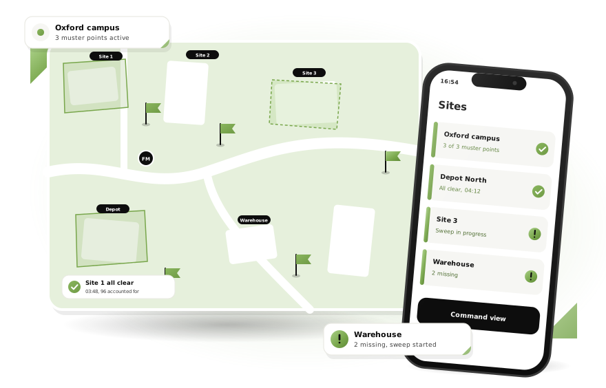
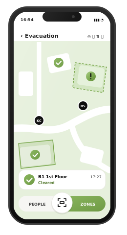

Each zone is shown at its real location on the map, with an icon whose colour shows its status: cleared, unsafe, or any other status you have set up. The whole site reads at a glance, so nothing is skipped.
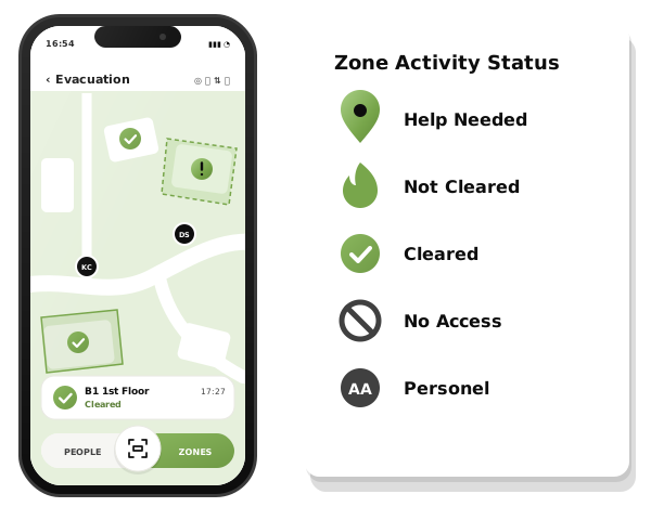

Unsafe zones are flagged on the map alongside the last known locations of anyone not yet accounted for. Command teams see where the gaps remain and direct search and rescue to them first.
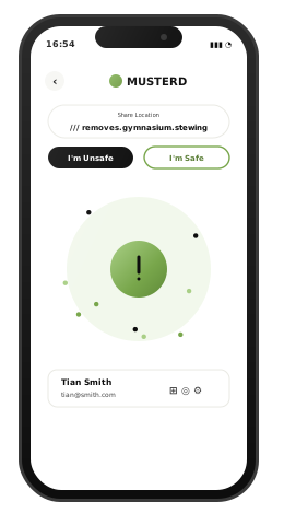

Use the map to plan and test evacuation routes and muster points as your buildings change, and share exact locations with what3words, so the emergency services and your own teams go straight to the right place.
 Real-Time Data on Any DeviceA cloud-based roll call that shows the same live picture on every modern iOS and Android phone, tablet and specialist device.Learn more
 Instant UNSAFE AlertsThe moment a roll call starts, Musterd shows who is UNSAFE and where they were last seen.Learn more
 Text Unsafe IndividualsSend a text to anyone still marked UNSAFE, straight from the app, to confirm their status and location.Learn moreInteractive Site MapsYour zones on a map, at their real locations, with each one’s status shown by a colour-coded icon.You are here
 Multi-Site ScalabilityFrom a single building to sites across the country, with each muster point run by its own team.Learn more
 Remote Incident OversightKeep incident managers and health and safety directors informed, in real time, wherever they are.Learn more
 Sweep & ClearPhysical QR code signs let fire marshals sweep every area of a building, and no one is left behind.Learn more
 Responder Location TrackingTrack the real-time location of fire marshals and responders as they sweep your site.Learn more
 Works in Poor VisibilityA roll call that stays clear in darkness, heavy rain or a power cut.Learn more
 Disabled Personnel SupportFlag disabled personnel who need assistance, so the people responsible for helping them know at once who to reach first.Learn more
 Post-Event Compliance ReportingTime-stamped reports that show how your drills and evacuations performed.Learn more
 Martyn’s Law ReadinessReal-time accountability, documented procedures and clear audit trails to help demonstrate preparedness under Martyn’s Law.Learn more
“The Musterd Roll Call app has been a great success and we have tested it a number of times.”Read the full testimonial
Hosted on Microsoft Azure, certified to ISO 27001 and Cyber Essentials Plus, registered with the Information Commissioner’s Office, and awarded a place on G-Cloud 15 as a Government Commercial Agency supplier.




















See Interactive Site Maps in a live demo
A live, 45-minute guided demonstration of Musterd with a member of our team, who can answer any questions and provide costs. No obligation.